At least 11 proposals to expand Miami-Dade County’s Urban Development Boundary are now in the pipeline. The largest group since 2005, according to Caplin News’ reporting. Together, the proposals cover more than 1,400 acres and include plans for warehouses, logistics facilities, data centers and housing.
That figure describes proposals seeking to move development beyond the line; it does not mean 11 projects have been approved or that all were filed this month. But the scale is changing the debate. Instead of weighing a single exception at a time, Miami-Dade is facing a broader argument about where, and under what conditions, South Florida can grow.
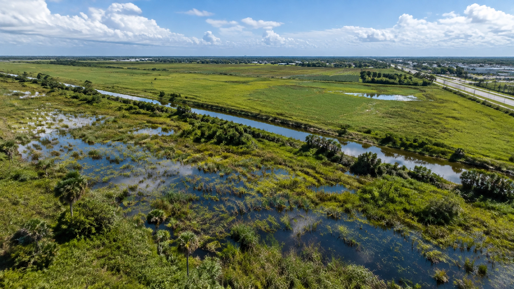
The stakes reach well beyond a map. The land outside the boundary includes wetlands, farmland and areas that help recharge the Biscayne Aquifer, the county’s primary drinking-water source. It also sits alongside the Everglades restoration landscape, where the health of the ecosystem depends on water moving through South Florida in the right amounts and at the right time.
What the Urban Development Boundary does
Miami-Dade’s Urban Development Boundary, or UDB, is the growth-management line on the county’s comprehensive plan map. First depicted in 1983, it separates areas where urban development may occur in the near term from areas intended to remain largely rural, agricultural or open.
The line is not an absolute ban on development beyond it. County rules allow proposals to seek an amendment, subject to planning review and a commission vote. But crossing the UDB is meant to be an exception, not the routine next step when a developer finds land outside the line attractive.
The county’s 2021 Urban Expansion Area Report explains that land outside the UDB serves environmental and economic functions, from filtering water and providing wildlife habitat to supporting agriculture and reducing flood risk. It also states that county analysis at the time found enough residential capacity inside the boundary to accommodate projected growth beyond 2040, alongside additional land in designated Urban Expansion Areas.
That report is a planning document, not a current inventory of every available parcel or a decision on today’s applications. Still, it underscores the central question for each proposal: Has the county demonstrated a need to move the boundary, and is this particular location suitable for urban development?

Why 11 applications change the scale of the debate
A single boundary amendment can be assessed on its own merits. A wave of applications raises a larger question: whether repeated exceptions could gradually change the purpose and practical meaning of the line.
Among the proposals identified in recent reporting are the South Dade Logistics Hub, a planned industrial and technology project near the former Homestead Air Reserve Base; housing and retail proposals; and projects involving agricultural land and the Bird Drive Basin. The applications differ in size, uses and environmental conditions. They should not be treated as interchangeable, or as already approved.
But each application asks the county to weigh development benefits against the functions of land beyond the boundary. That includes not only what is built on one parcel, but also what roads, drainage, water and sewer services may be required to support it.
The county’s CDMP amendment-cycle information lays out how proposed changes to the Comprehensive Development Master Plan move through review. That process matters because the UDB is part of the plan: a boundary change is a land-use decision with long-term effects, not simply a site-specific construction permit.
Kelly Tractor shows what is at stake, and how the process can work
The clearest recent test is Kelly Tractor’s proposed heavy-equipment facility west of NW 137th Avenue and the Dolphin Expressway. The project would occupy roughly 246 acres beyond the UDB and include a large complex of buildings and related facilities.
The company has argued that a new headquarters would let it expand equipment sales, storage, repair and maintenance operations. Those services support construction and infrastructure work, and the project’s backers have pointed to jobs and economic activity as benefits.
Environmental advocates and county staff raised different concerns about the site, including wetlands, floodwater storage and whether the need for this use justified expanding the boundary. In February, Mayor Daniella Levine Cava vetoed the commission’s earlier approval and rallied supporters to sustain the veto. Her argument, as reported by WLRN, was that wetlands function as public infrastructure: they help filter water, recharge supplies and absorb floodwaters.
The dispute did not end there. In September, the County Commission approved a revised Kelly Tractor plan by a 9–3 vote, enough to overcome the mayor’s veto. The revised proposal included commitments to preserve at least 63 acres of wetlands on site and acquire additional land for conservation, according to the meeting summary and related reporting.
That approval is not a blanket green light for the other applications. Each still requires its own review and decision. But it has become a test case: supporters see a negotiated project with conservation commitments; opponents warn that approving development beyond the line makes it harder to defend the boundary the next time.

The Everglades connection runs through water
The Everglades is not limited to the boundaries of a national park. Its water system is connected to wetlands, canals, aquifers and developed areas across the region. Decisions on land near the urban edge can affect how water is stored, filtered and moved, even when a proposed project is not directly inside the Everglades.
Miami-Dade’s 2021 report identifies wetlands as important to aquifer recharge and natural flood protection. It describes the Bird Drive Wetlands as a prime recharge area, citing their infiltration capacity, rainfall and role in improving the quality of water reaching the aquifer. The report also notes that the Biscayne Aquifer is vulnerable to contamination from activity at the land surface.
Environmental advocates have also highlighted habitat concerns. Freshwater marshes and wetlands can support the Everglade snail kite, an endangered raptor that feeds primarily on apple snails. The county report notes that snail kites have been documented in Everglades National Park, Water Conservation Area 3, the C-111 Basin and smaller wetlands in the region; habitat loss and degradation are recognized threats.
That does not mean every UDB application would cause the same impacts. The location, wetland conditions, project design, drainage plan and mitigation measures all matter. It does mean that “outside the boundary” is not synonymous with “empty land.” A site may play a role in water management or habitat even if it looks undeveloped on a parcel map.
The same-day Palm Beach County data center lawsuit involving PBA Holdings and TPA Group offers a separate example of how development proposals tied to AI infrastructure are prompting local scrutiny. It is a different county and a different land-use process, but it highlights a regional question: how should South Florida assess large projects that require land, utilities and infrastructure near sensitive water resources? South Florida Digest has also reported on data center proposals and water-use concerns near the Everglades.
Growth arguments deserve a full hearing
Developers and business advocates argue that South Florida needs space for housing, logistics, industrial services and emerging industries. They may contend that some uses require large sites or particular access to highways and utilities, and that projects can bring jobs, investment and tax revenue.
Those are legitimate considerations. So are questions about whether proposed jobs are permanent, whether infrastructure costs are fully accounted for, whether housing plans address local needs and whether similar sites exist inside the boundary.
County policy requires UDB applicants to address matters such as public facilities, water and sewer service, transit, roads, environmental protection and the project’s fiscal effects. The county should weigh those details transparently, rather than reducing the debate to a choice between all growth and no growth.
The political argument has also reached Tallahassee. In March, a coalition of South Florida leaders urged lawmakers, and, if necessary, the governor, to reject a pro-development bill tied to the UDB debate. The UDB-related provisions were later removed from the bill before passage, according to WLRN’s coverage of the coalition’s call. The episode showed that the boundary question is not only a county planning matter; state-level changes could alter how much authority local officials have over growth.

The decision ahead is about the line itself
With at least 11 applications in play, Miami-Dade’s task is bigger than deciding whether each proposal can meet a checklist. Commissioners and residents must also consider what repeated approvals, or denials, would mean for the county’s growth pattern.
A boundary that changes only after a clear demonstration of need, careful site review and enforceable safeguards remains a planning tool. A boundary that moves project by project without a consistent standard risks becoming a line in name more than a guide to where growth should go.
The Everglades, the Biscayne Aquifer and the communities on the urban edge are all part of that calculation. The question is not whether South Florida will grow. It is whether the region can direct that growth without compromising the land and water systems it depends on.