Thursday, Oct. 22, 2026
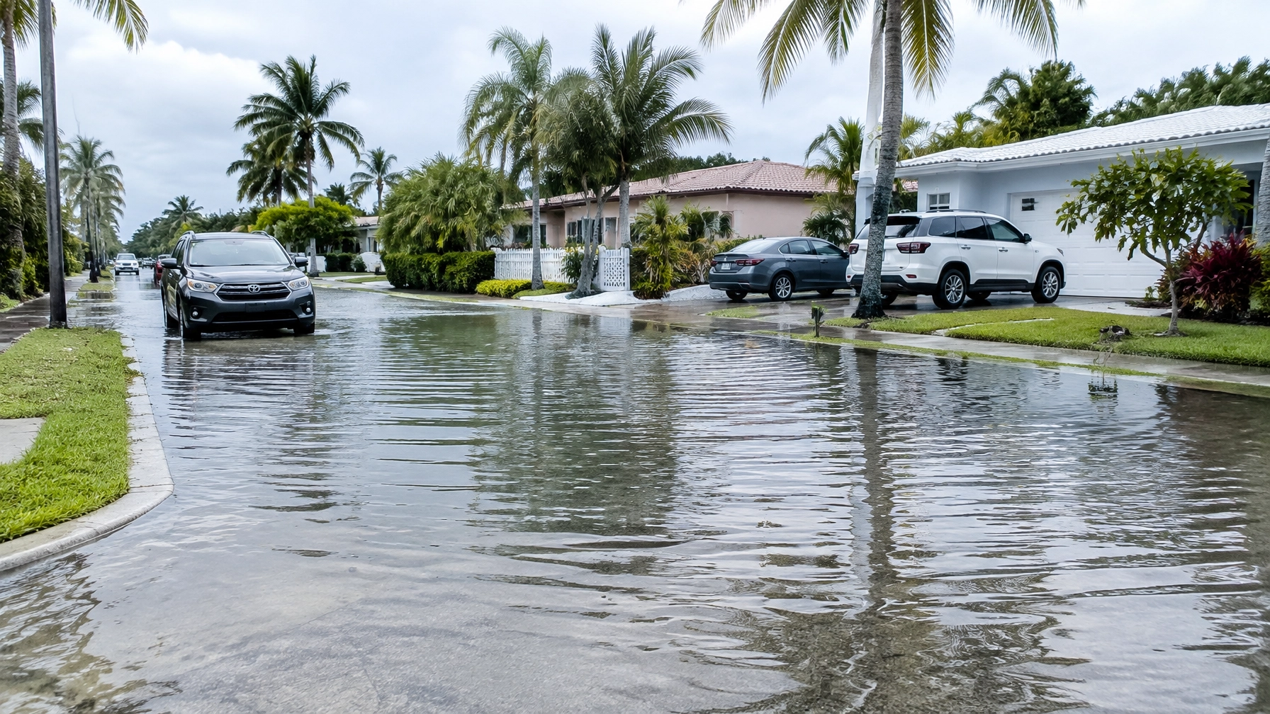
South Florida’s coastal flood risk is rising just as a wet, windy stretch approaches. The National Weather Service has upgraded coastal flood statements to advisories for Miami-Dade, Broward and Palm Beach counties, warning of moderate flooding around high tide. The concern grows this weekend, when heavy rain and strong onshore winds could arrive during the highest king tide of the season so far.
For coastal Miami-Dade and Broward, the NWS advisory runs through 8 p.m. EDT Saturday, Oct. 24. Flooding may affect roads, parking lots and other low-lying areas. Residents should check current alerts before traveling: conditions and advisory periods can change. NWS Miami posts local forecasts and watches, warnings and advisories.
When to watch
The king tide event spans Oct. 24–30. Tuesday, Oct. 27, is expected to bring the East Coast’s annual astronomical peak; in the Florida Keys, the highest levels are expected Oct. 28 and 30. Water levels can vary by location and may rise beyond the predicted tide when winds push water toward shore.
For Thursday, NBC 6 lists high tides at 5:54 a.m. and 6:11 p.m. in Miami Beach; 5:46 a.m. and 6:05 p.m. in Fort Lauderdale; and 5:45 a.m. and 6:05 p.m. in Palm Beach. These times are location-specific. Check local tide information and updated forecasts for your area.
Saturday is currently shaping up as the better weekend day, but scattered thunderstorms remain possible. The Weather Prediction Center has flagged a slight risk of excessive rainfall and flash flooding for Saturday, level 2 of 4, focused along the East Coast metro from near Port St. Lucie down to northern Miami. Sunday and Monday could be more difficult: CBS Miami’s NEXT Weather team has issued an alert for Sunday through Tuesday, when widespread rain and gusty winds could overlap with high tides.

Rain, wind and high water could compound flooding
NBC 6 reports 2 to 4 inches of rain are possible this weekend into early next week, with locally higher amounts. The NWS low-impact scenario is 1–2 inches; a more concerning scenario is 5–7 inches over 48 hours, with isolated areas potentially approaching twice that. Forecast totals and the locations of the heaviest rain remain uncertain.
Winds may add to the coastal risk. Northeast and east winds can push extra water toward shore, raising levels beyond the astronomical tide alone. Sunday could bring sustained winds of 25–30 mph, with gusts over 40 mph possible, according to the NWS outlook cited by local weather teams.
The practical problem is the overlap: heavy rain falling on top of an elevated tide cannot drain as easily. When sea levels stay high, stormwater has nowhere to go through drainage systems. Some neighborhoods may flood from seawater and rainwater at the same time.
That is a familiar concern in flood-prone parts of the region. At a Tuesday, Oct. 20, Deerfield Beach City Commission meeting, residents demanded answers and long-term fixes after flooding damaged homes and displaced families. In Hollywood, city crews and local businesses have been installing barriers ahead of possible flooding.
Steps to take before the water rises
If your home or workplace is in a repeatedly flooded area, prepare before the weekend:
- Move belongings out of harm’s way. Lift tools, boxes, chemicals and other valuables from garage floors. Move vehicles from low-lying lots or flood-prone streets to higher ground if possible.
- Plan around high tide. Avoid parking in known flood spots, and allow extra time for trips during high-water periods. Check the latest forecast and local alerts before heading out.
- Do not drive through saltwater. Floodwater can hide debris, damage a vehicle or stall its engine. Turn around and find another route; never assume shallow-looking water is safe.
- Document existing or new damage. Photograph affected rooms, vehicles and belongings, note dates and water levels if safe, and keep records of cleanup and repairs. This can help residents on repeatedly flooded blocks track impacts and support insurance or assistance claims.

Beach conditions are hazardous too. A high risk of rip currents continues along Atlantic beaches through Friday. Palm Beach County is under a High Surf Advisory, with breaking waves of 5–7 feet. Check beach conditions and follow lifeguard instructions; do not enter the water when warnings are in effect.
A brief note for people heading west: the same onshore pattern can push water into Florida Bay and the southern Everglades. Low-lying park roads and trails can flood during these tides, so check conditions before traveling.
The tropics are not the source of this South Florida threat. The National Hurricane Center reports Subtropical Storm Josephine accelerating northeast away from the United States, with 65 mph maximum sustained winds, and expected to become an extratropical cyclone. It is not a South Florida threat. The NHC is also monitoring another Atlantic disturbance with about a 10% chance of development.
For updates, follow NWS Miami, your county’s emergency-management pages and local forecast updates. NBC 6’s king tide and rain report and CBS Miami’s weekend outlook provide additional forecast details. With high water, onshore winds and rain potentially converging, the forecast may shift, but preparation should not wait for the worst-case scenario.